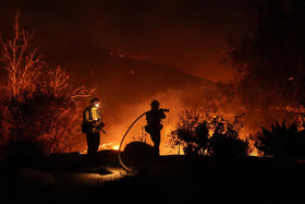
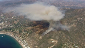
Updated October 15, 2026, 9:35 p.m. Pacific Time. The Bryson Fire near Encinal Canyon Road in Malibu triggered evacuation orders and warnings as firefighters responded to a wind-driven brush fire in the Santa Monica Mountains. The latest CAL FIRE incident page listed the fire at 200 acres, with evacuation orders for KAN-U017 and SYC-U016-A and warnings across several nearby zones. Conditions can change quickly; use official live maps before making travel or evacuation decisions.
Is Pepperdine University’s Malibu campus safe?
Pepperdine University said on October 15 that the Bryson Fire was approximately eight miles northwest of its Malibu campus. University officials reported that winds were blowing southwest and away from campus, and that the fire did not then pose a threat to the Malibu campus. The university noted that smoke and firefighting aircraft might be visible. That was a time-specific update, not a guarantee about future conditions.
Students, staff and visitors should monitor Pepperdine’s official emergency notice and follow any campus alerts or instructions from local authorities.
Which Malibu areas are under evacuation orders or warnings?
In the CAL FIRE incident update available at 9:35 p.m. Pacific on October 15, evacuation orders were listed for KAN-U017 and SYC-U016-A. Evacuation warnings were listed for CRN-U019, LBO-U018, LEO-U015, MAL-C113, MAL-C114, MCR-U021-A, MLK-U020, SYC-U016-B, SYC-U016-C, SYC-U016-D, VST-U046 and WLV-C201. These zone labels are easy to confuse, so residents should search their exact address in the official map rather than rely on a broad description of “Malibu.”
Check CAL FIRE’s live Bryson Fire incident page and Genasys Protect’s evacuation map for the newest status. The fire agency’s page listed Agoura High School, 28545 W. Driver Avenue, Agoura Hills, as an evacuation shelter, and Agoura Animal Care Center, 29525 Agoura Boulevard, as an animal evacuation shelter. Confirm availability and instructions with officials before traveling.
Why can a brush fire spread so quickly?
The incident began during a period of elevated fire danger. The National Weather Service’s Red Flag Warning, cited by Pepperdine, was expected to continue through Saturday at 8 p.m. Pacific. Strong, dry winds can push flames through grass and chaparral, carry embers ahead of the main fire and create spot fires that complicate containment. Steep terrain can also make access and hose deployment more difficult. These are general wildfire dynamics; officials had not yet determined the Bryson Fire’s cause.
CAL FIRE listed the cause as under investigation. Early reports should not be treated as proof of how the fire started, and acreage or evacuation boundaries may be revised as crews obtain better information.
What residents should do now
- If your zone is under an evacuation order, leave immediately. Do not wait to see flames or smoke.
- If you are under an evacuation warning, prepare to leave, gather medication, identification, essential documents, pets and chargers, and follow local instructions.
- Use official evacuation maps and local fire or sheriff alerts; do not rely on screenshots or old social posts.
- Expect changing road conditions and never drive through smoke or a closed road.
- Keep phones charged and check on neighbors who may need help, without delaying your own evacuation.
Official updates and video
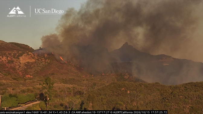
The official CAL FIRE incident page includes a Bryson Fire time-lapse video and links to ALERTCalifornia camera feeds. These sources are more useful for current situational awareness than unrelated archive photos or unverified social clips.
Watch the official Bryson Fire time-lapse and check incident updates.
Open ALERTCalifornia camera feeds.
Quick answers
Is Pepperdine’s Malibu campus under evacuation?
Pepperdine’s October 15 notice said the Bryson Fire did not then pose a threat to its Malibu campus. Check the university’s emergency page for any newer notice.
Where can I find the current evacuation map?
Use Genasys Protect and the CAL FIRE Bryson Fire page. Enter the exact address or zone and recheck frequently.
What caused the Bryson Fire?
The cause was listed as under investigation in the official incident information available on October 15, 2026.
Where is the evacuation shelter?
CAL FIRE listed Agoura High School at 28545 W. Driver Avenue in Agoura Hills as a shelter in its 9:28 p.m. update. Confirm the shelter remains open before traveling.
Sources
- CAL FIRE — Bryson Fire incident status, evacuation zones and time-lapse
- Pepperdine University — campus status notice
- LAist — Bryson Fire reporting and AlertCalifornia image credit
- Genasys Protect — evacuation map
Reporting note: This is a developing emergency. Zone status, acreage, shelter availability and campus conditions may change after publication. Follow instructions from emergency officials.
Author: Shivam Das