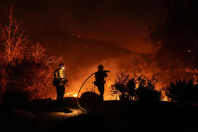
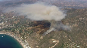
Last updated: October 15, 2026, 9:45 p.m. Pacific Time. The Bryson Fire in Malibu’s Encinal Canyon area has grown to approximately 200 acres, with containment reported at 0% in the latest evening updates. Evacuation orders and warnings are in effect in parts of the surrounding area. Because boundaries can change quickly, residents should use the live official map—not a static screenshot—to determine whether a specific address is affected.
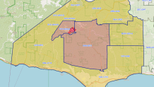
Where are evacuation orders in effect right now?
As of the latest CAL FIRE incident-page update checked for this report, evacuation orders were listed for zones KAN-U017 and SYC-U016-A. Evacuation warnings were listed for CRN-U019, LBO-U018, LEO-U015, MAL-C113, MAL-C114, MCR-U021-A, MLK-U020, SYC-U016-B, SYC-U016-C, SYC-U016-D, VST-U046 and WLV-C201. Zone lists and boundaries may change without notice, so check the official map before making decisions.
Check your address on the live evacuation map: Genasys Protect — official evacuation zones. For the incident status and updates, use the CAL FIRE Bryson Fire page and Los Angeles County emergency updates.
What we know about the Bryson Fire
The fire was reported shortly before 5 p.m. Thursday near Encinal Canyon Road and Mulholland Highway, in rugged terrain near the Ventura County line. CAL FIRE’s incident page listed the blaze at about 200 acres in its 9:28 p.m. update, with the cause still under investigation. The latest reports reviewed for this article listed no structures destroyed, injuries or deaths reported at that time; those figures can change as responders complete assessments.
Fire behavior has been made more dangerous by hot, dry and windy conditions. A Red Flag Warning covers parts of Los Angeles and Ventura counties through Saturday evening, according to local emergency information. Strong winds can carry embers ahead of the main fire, creating spot fires and making a fire perimeter difficult to predict. That is why an area outside the visible smoke plume may still receive a warning or evacuation order.
Is Pepperdine University threatened?
Pepperdine University said the fire was about eight miles northwest of its Malibu campus and that winds were blowing southwest, away from campus. The university’s emergency information page said the fire did not currently pose a threat to the Malibu campus when its statement was posted. Students, staff and nearby residents should continue to monitor official updates because wind direction and evacuation conditions can change.
Read the university’s notice at Pepperdine Emergency Information.
Road closures, shelters and practical next steps
Local reports listed closures at Decker Road and Encinal Canyon Road, Kanan Road and Mulholland Highway, and Mulholland Highway and Westlake Boulevard. Check county and road-agency notices before traveling; do not drive toward a fire zone to view it or collect photos.
The listed evacuation shelter is Agoura High School, 28545 W. Driver Avenue, Agoura Hills, CA 91301. The listed animal evacuation center is Agoura Animal Care Center, 29525 Agoura Boulevard, Agoura Hills, CA 91301. Verify shelter availability with local authorities before setting out.
- Follow an evacuation order immediately; do not wait to see flames.
- If you are under a warning, prepare to leave, especially if you need extra time, have pets, or require mobility assistance.
- Charge phones and essential devices, keep medication and documents together, and take pets if time permits.
- Never cross road closures or enter a restricted area.
- For immediate danger, call 911. For your address-specific status, use the official live map and local emergency alerts.
Watch the official fire update
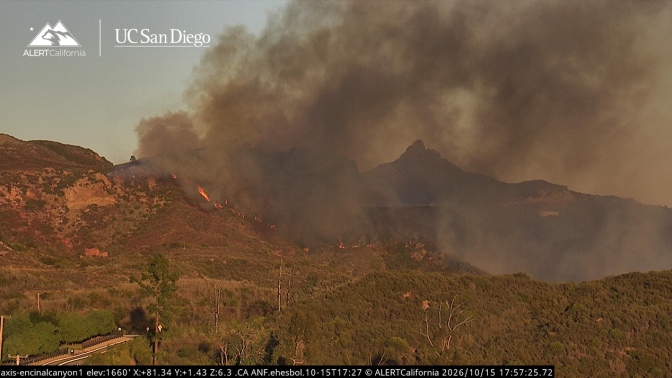
CAL FIRE has posted a Bryson Fire time-lapse video and links to nearby AlertCalifornia camera feeds on its incident page. Those official feeds are more useful for observing changing conditions than reposted clips without a verifiable location or timestamp.
Open the CAL FIRE incident page to view the time-lapse and camera links.
Frequently asked questions
Which Malibu areas are under evacuation order?
The latest CAL FIRE listing checked for this article showed orders for KAN-U017 and SYC-U016-A. Check Genasys Protect for the current map and address-level status because zones may change.
Where can I find the Bryson Fire evacuation map?
Use Genasys Protect, the official live evacuation map. Do not rely on screenshots alone.
How large is the Bryson Fire?
CAL FIRE reported approximately 200 acres in its 9:28 p.m. Pacific update on October 15, 2026. The size may change as crews update the perimeter.
Is Pepperdine University under evacuation order?
Pepperdine said the fire did not then pose a threat to its Malibu campus. Follow the university’s emergency page and official county alerts for changes.
Where is the evacuation shelter?
The shelter listed in the incident update is Agoura High School, 28545 W. Driver Avenue, Agoura Hills, California. Verify that it remains open before traveling.
What caused the Bryson Fire?
The cause was listed as under investigation in the latest CAL FIRE information checked for this article. No cause should be assumed until authorities confirm it.
Sources and live updates
- CAL FIRE: Bryson Fire incident status, updates and official video
- Los Angeles County emergency information
- Pepperdine University emergency updates
- NBC Los Angeles reporting
- LAist reporting and AlertCalifornia image credit
Reporting note: This is a developing emergency. Details reflect official and local reporting available at the time shown above; evacuation instructions from authorities take precedence over this article.